


Platform
The FieldKit Platform
Environmental Monitoring Made Accessible
FieldKit is a modular environmental sensing platform combining rugged hardware, precise sensors, and user-friendly software to democratize high-quality environmental data collection. The system features an open-architecture logger that connects to custom FieldKit sensors, supported by a mobile app for field use and a web portal for data visualization and collaboration. This cohesive platform lowers technical and financial barriers to field monitoring, empowering conservation groups, educators, researchers, and communities to collect and act on trustworthy environmental data.

Questions about our technical stack?
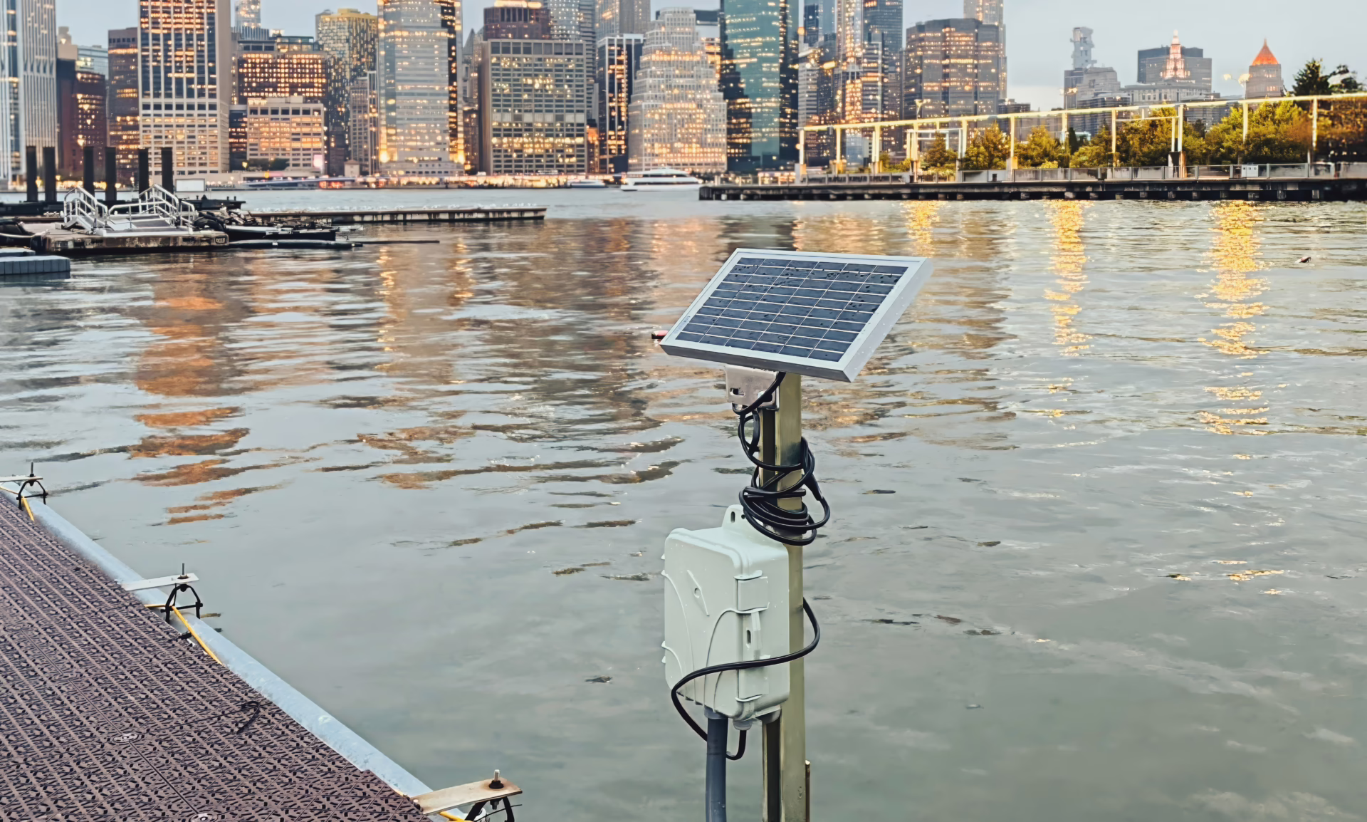
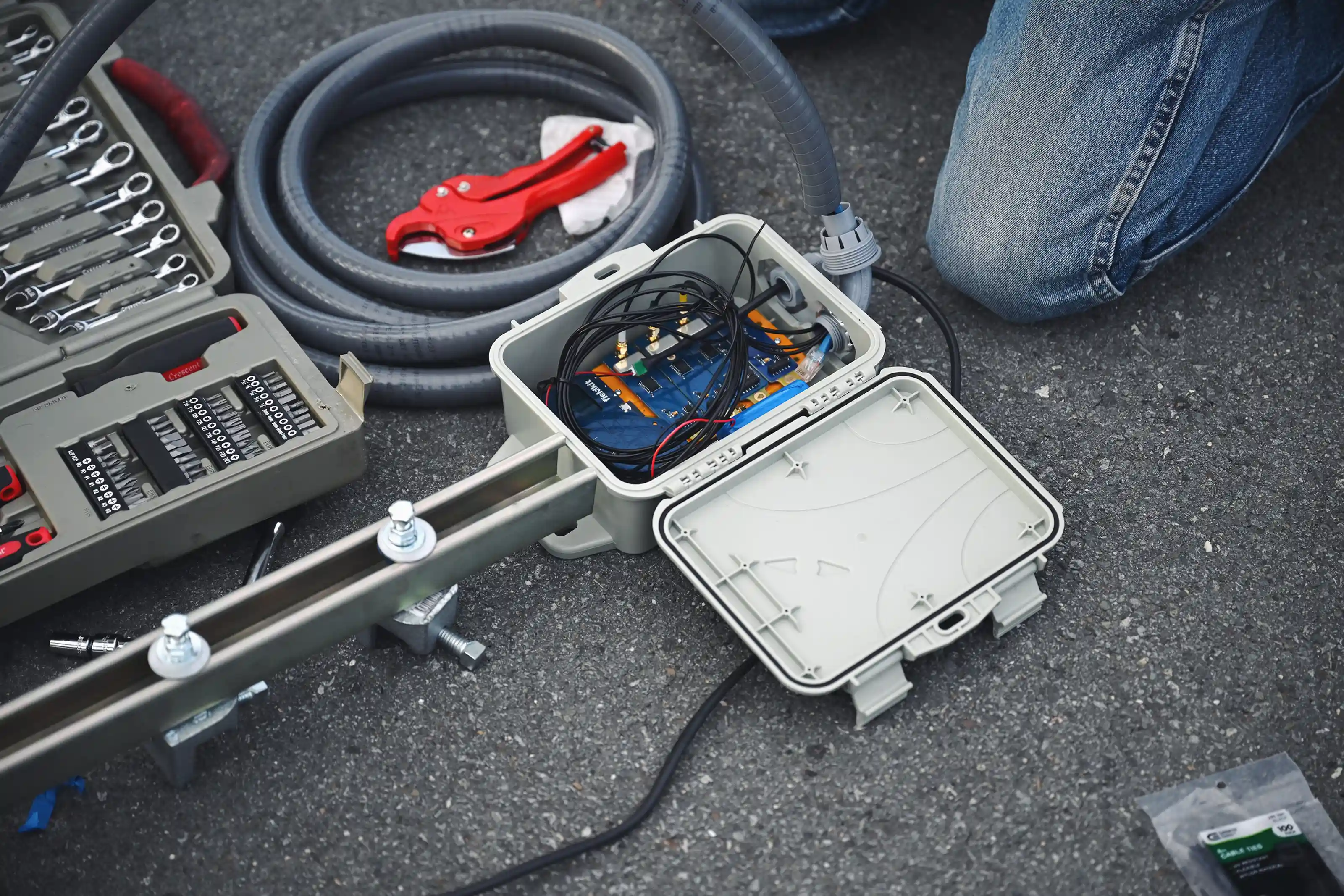
Data Logger
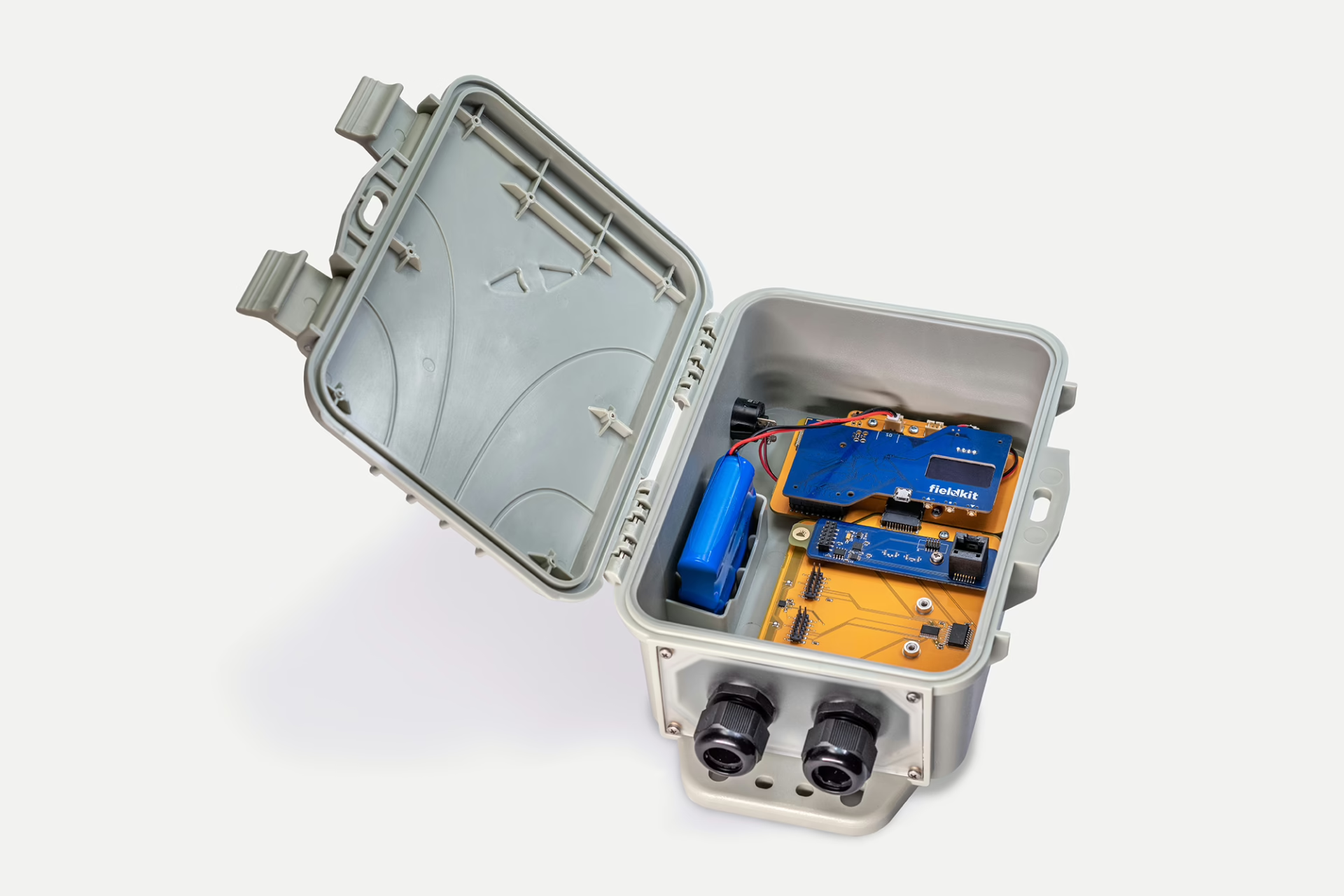
Modular FieldKit hardware allows you to gather high-quality data across various modalities for your project and connect to our data conversation portal through an easy-to-use mobile app. This enables you to deploy an array of sensing systems to capture more data at lower cost, creating greater spatial diversity, more measurements, and enhanced redundancy. It’s a system you can trust anywhere, gathering data you can be confident in.
Data capture frequency is customizable via the mobile app and can be set as frequently as every minute. Integrated GPS provides location and timestamp data, synchronized across all four sensor module bays.
- Powered by a SAMD51P series 32-bit low-power microcontroller
- Connects up to four FieldKit sensors via I²C with synchronized, GPS-augmented timestamps
- Wi-Fi enabled with onboard data logging to microSD (.csv); LoRa-capable for future use
- Rugged, modular design supports long-term field deployment and platform extensibility, including a field-tested weatherproof case
- Supports solar charging and battery backup – capable of running weeks to months unattended with optimized sensor modules
- Data retrieval over wireless access point built into logger
- Benefits: High precision logging without proprietary lock-in; future-ready for connectivity upgrades (e.g. cellular)
| Flash Memory | 512 MB |
| Included Battery Capacity | 37 Watt / Hours |
| Solar Panel Voltage | 12V Nominal, 15V Max |
| Operating Temperature Range | -20 – 60ºC |
| Battery Charging Temperature Range | 0 – 45ºC |
| Measurement Frequency | 30 seconds to 24 hours |
| Precision | See module specifications |
Here are some of the ways in which the FieldKit compares with other loggers.
| Feature | FieldKit | Campbell Scientific CR1000Xe | Meter ZL6 Basic | Hobo RX3000 Series |
|---|---|---|---|---|
| Flash Memory | 2Gb | 72MB | 2MB | 32MB |
| Battery | ● 37Wh | ✕ | ● 20Wh | ● 40Wh |
| Solar Battery Charger | ● | ✕ | ✕ | ● |
| Solar Panel | ● | ✕ | ✕ | Optional |
| Wi-Fi Connectivity | ● | ✕ | ✕ | Optional |
| GPS | ● | ✕ | ✕ | ✕ |
| Display | ● | ✕ | ✕ | ● |
| Weatherproof Enclosure | ● | ✕ | ● | ● |
| Temperature Monitoring | ● | ✕ | ✕ | ✕ |
| GPS Time Setting and Synchronization | ● | ✕ | ✕ | ✕ |
| Measurement Interval | 30 seconds to 24 hours | 1 millisecond | 1 hour (fixed) | 1 minute to 18 hours |
Mobile App
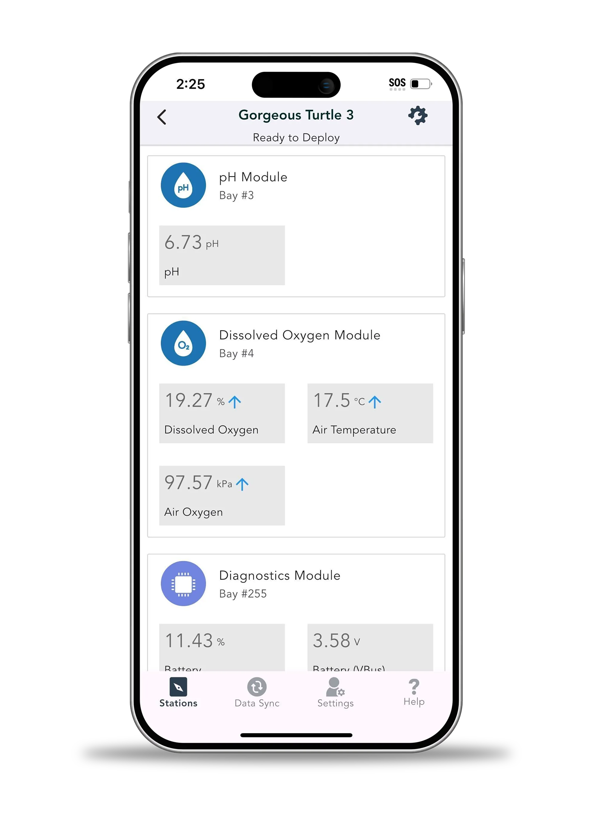
Connect directly to your station via our mobile app and reduce the need for finicky physical data retrieval. Our app simplifies configuring and calibrating your station, as well as downloading and viewing data effortlessly from your mobile device. And, with your data backed up to your mobile device, you don’t need to worry about dropping that microSD card in the field.
- Handles sensor calibration, GPS tagging, local data downloads (to .csv), and uploads to the FieldKit Data Portal
- Provides visual feedback and status updates in the field alongside contextual metadata
- Users can submit logs (from data logger) manually from app
- Designed for non-technical users and rugged, intermittent connectivity contexts
- Benefits: Simplifies deployment and reduces calibration errors; eliminates need for laptops or proprietary tools in the field
Data Portal
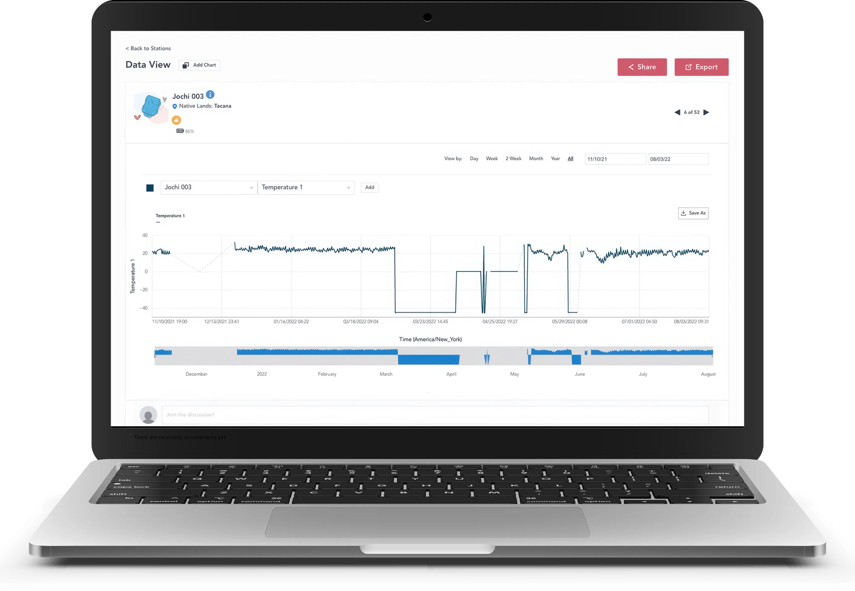
Station data comes to life within the FieldKit portal. Connecting to the portal lets you quickly and easily visualize station data, discover trends and patterns, add comments, and share your findings with anyone. If desired, collaborators and the public can comment on trends and ask questions. Or, you can keep your data private—no matter what, your data will always be yours and free to access and manipulate at no cost.
- Upload and visualize field data from FieldKit stations; create projects and share datasets
- Compare data from two different time periods or multiple sensors during the same time period on a single chart
- Enables centralized management of stations and their data, tied to collaborative projects and user accounts
- Supports data cleaning, charting, and download in open formats
- Enables team-based workflows and open science collaboration
- Each data view becomes its own unique URL, available for sharing or using as a reference
- Benefits: Turns raw field data into actionable insights; supports transparency, repeatability, and knowledge-sharing
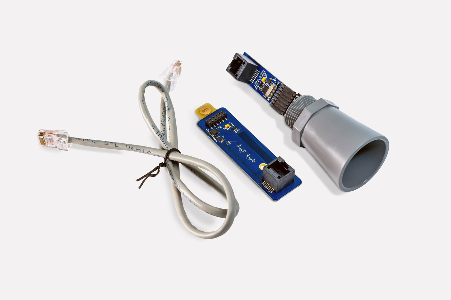
Sensors

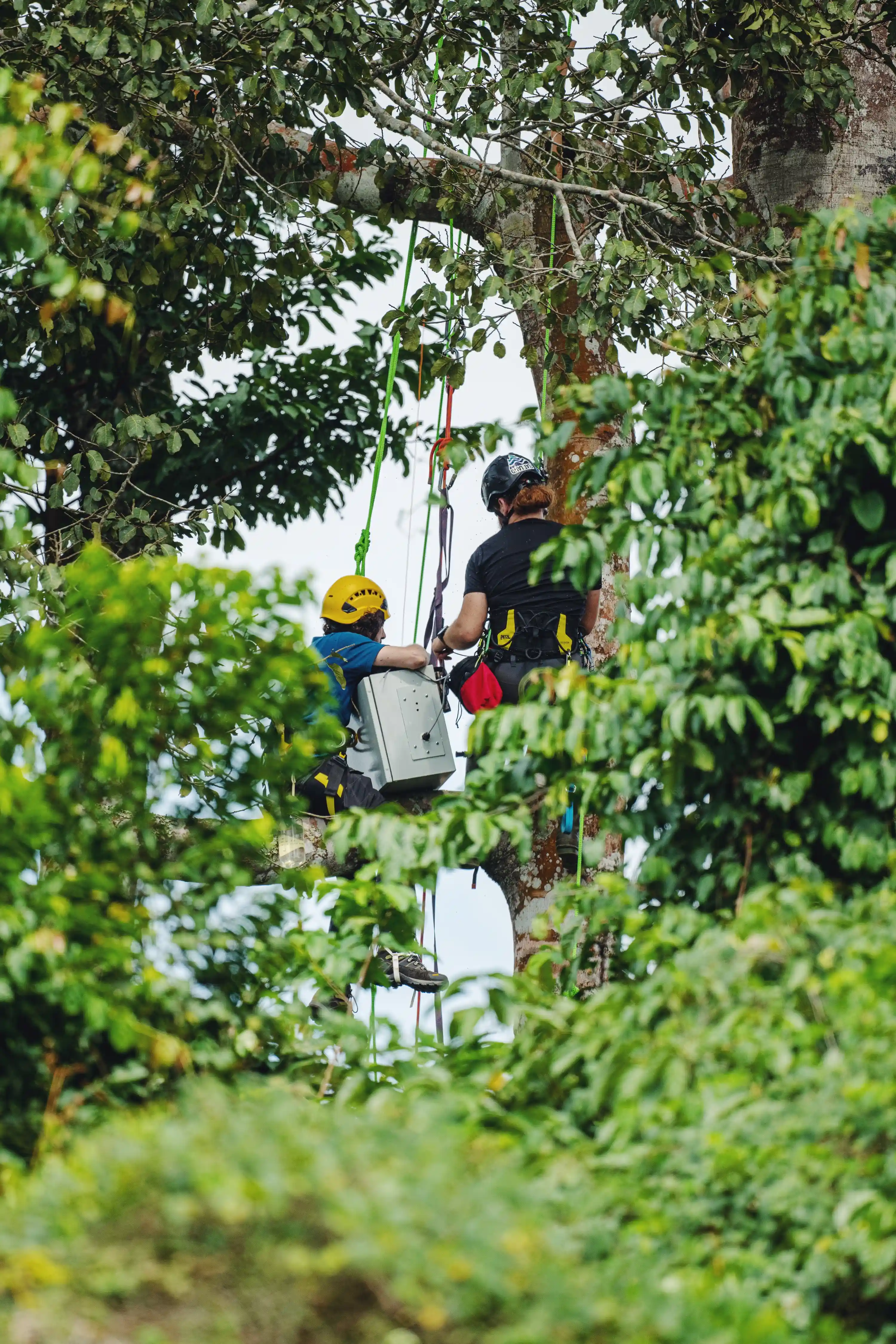
Our team develops high-quality, low-cost sensors that rival traditional tools, making broader spatial coverage and community-based maintenance feasible. The result is not only richer data, but a more equitable scientific project. Research-grade, rugged sensing at a fraction of the cost of traditional tools allows for dense deployments in highly varied terrain and environmental conditions.
All our sensors are modular and can be deployed on the data logger in whatever combination best fits your sensing needs.
- Mix and match water chemistry (pH, DO, EC, temp), distance/level, and weather sensors
- Designed for modularity, affordability, and open-spec calibration routines
- Seamlessly integrate with the logger with redundant storage to keep your data safe
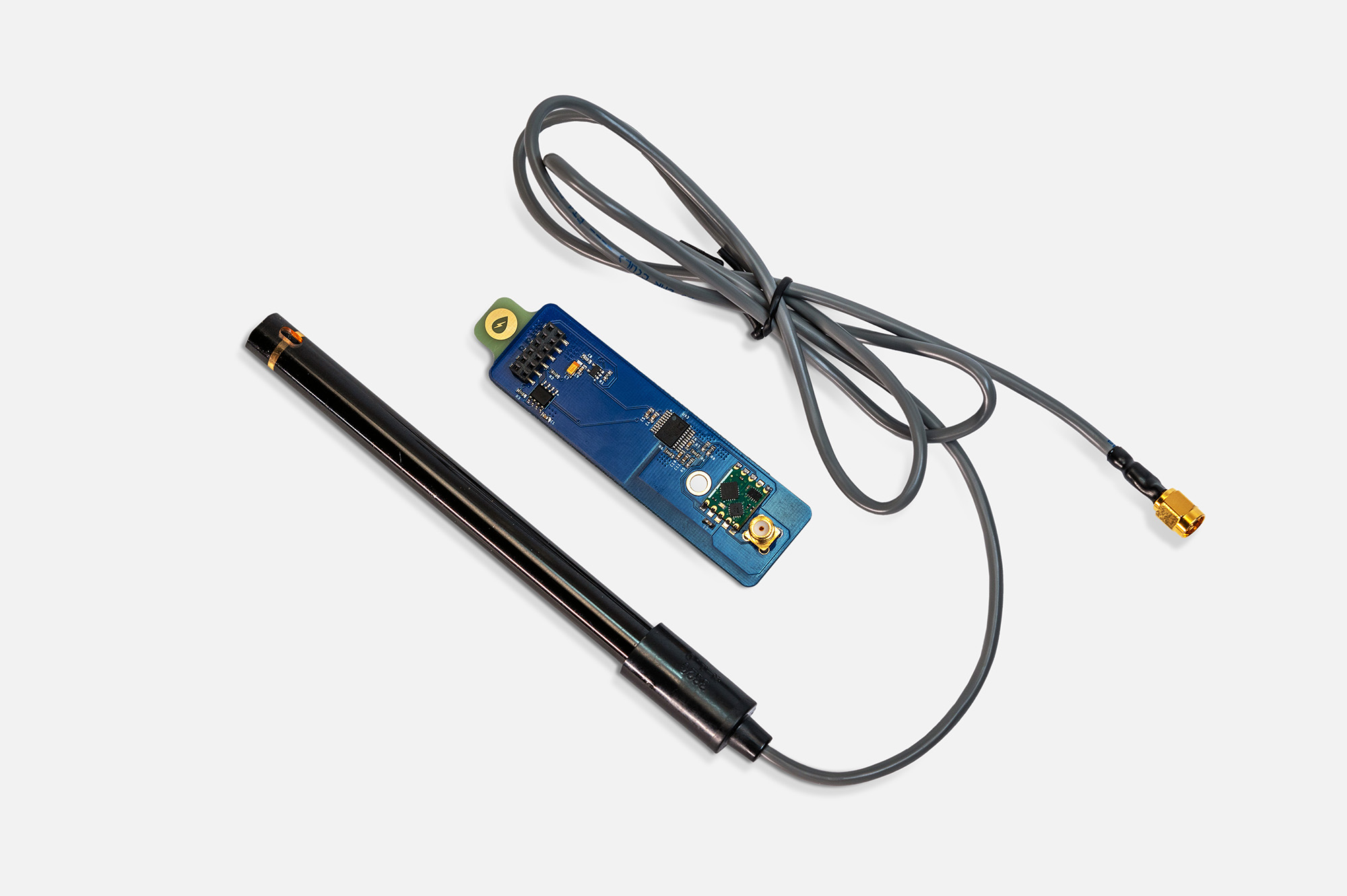
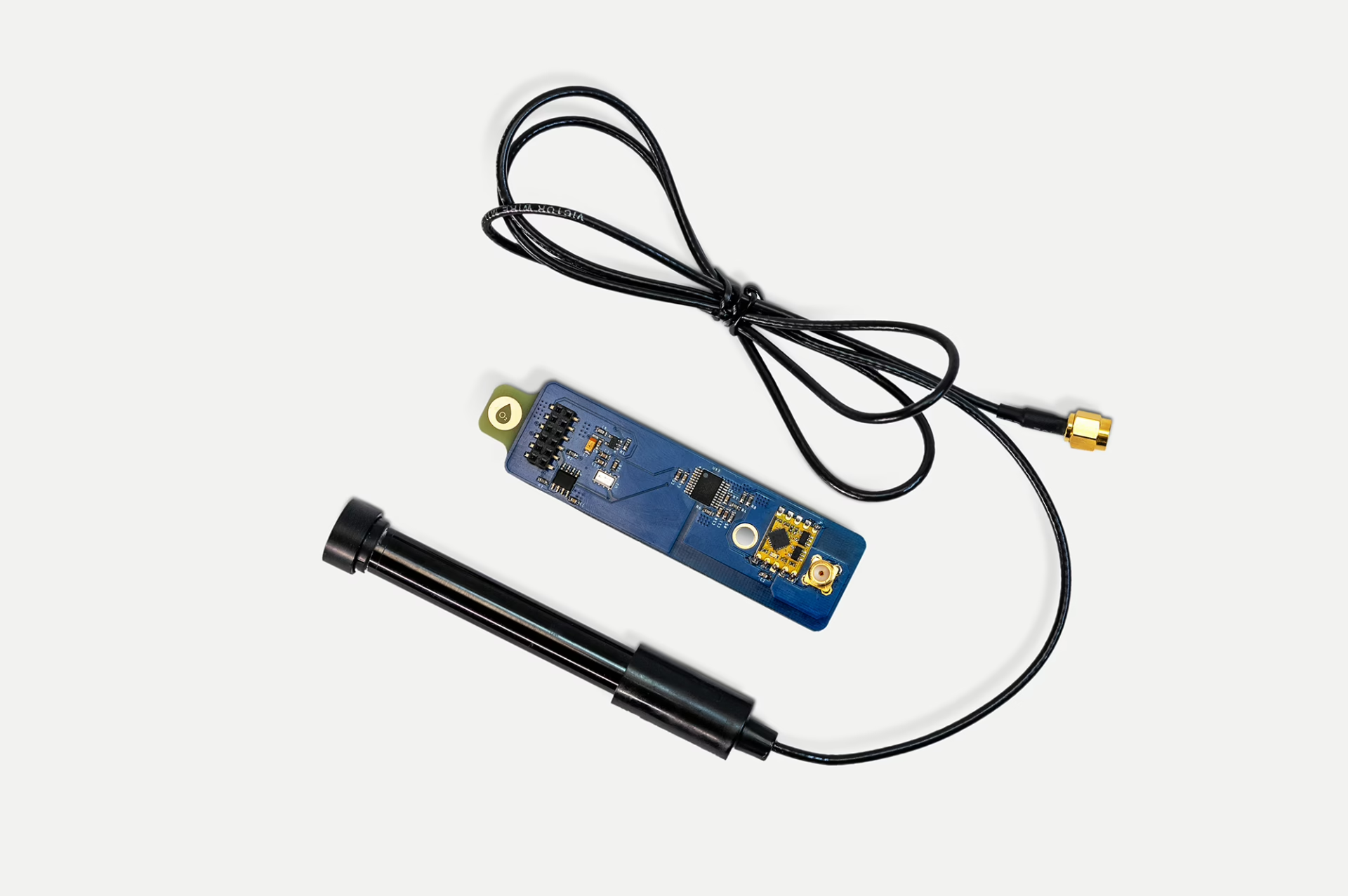
Our conductivity sensor measures how well a given sample of water conducts an electrical current by assessing the concentration of ions in said water in the form of a voltage. The more ions, the higher the electrical conductivity.
| Conductivity | 0 to 500000 (±10%) µS/cm |
| Probe Diameter | 12 mm |
| Temperature Range | 1-60 °C |
| Cable Length | 2 m |
| Interface | SMA connector on 50 Ω coaxial cable |
| Calibration Period | 6 months |
| Panel Footprint | 1 SMA connector |
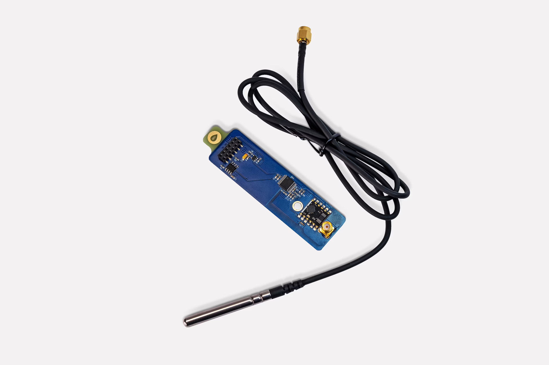
Our dissolved oxygen sensor measures the amount of oxygen present in a given sample of water. This measurement directly correlates to how hospitable that water is to organic life.
| Dissolved Oxygen | 0.0 to 20.9 (±0.2) %DO (Volume/Volume) |
| Probe Diameter | 16.4 mm |
| Temperature Range | 1-60 °C |
| Cable Length | 2 m |
| Interface | SMA connector on 50 Ω coaxial cable |
| Calibration Period | 3 months |
| Panel Footprint | 1 SMA connector |
Design Files and Schematics
Coming Soon
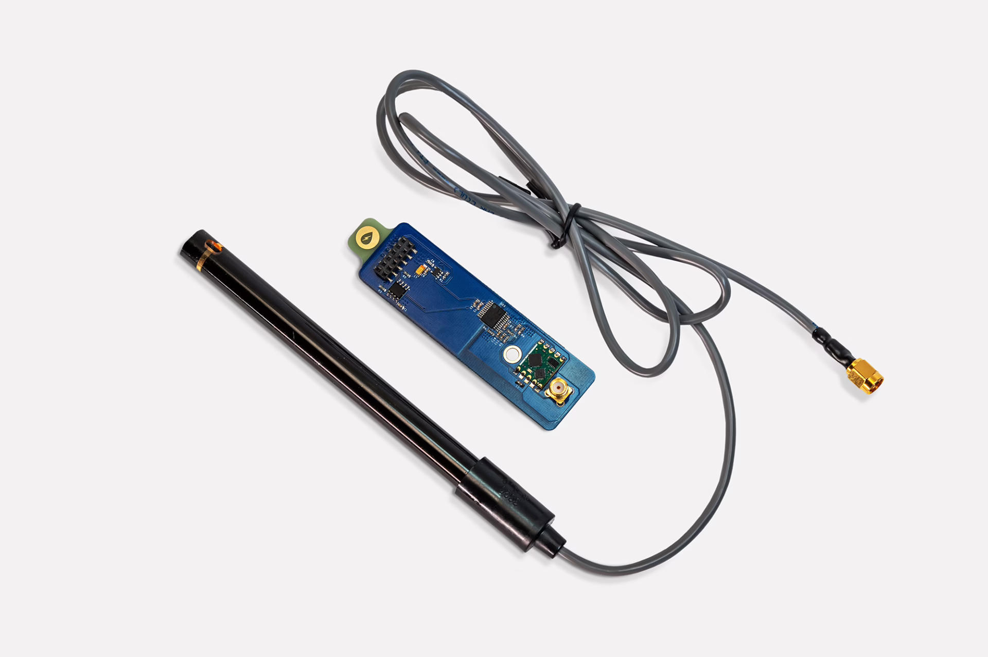
Our waterproof temperature sensor measures the temperature of water, soil, air, or wherever else it is placed and can operate across a broad range of temperatures.
| Temperature | -40-125 (±0.1) °C |
| Probe Diameter | 6 mm |
| Temperature Range | -40 to 125 °C |
| Cable Length | 2 m |
| Interface | SMA connector on 50 Ω coaxial cable |
| Calibration Period | 1 year |
| Panel Footprint | 1 SMA connector |
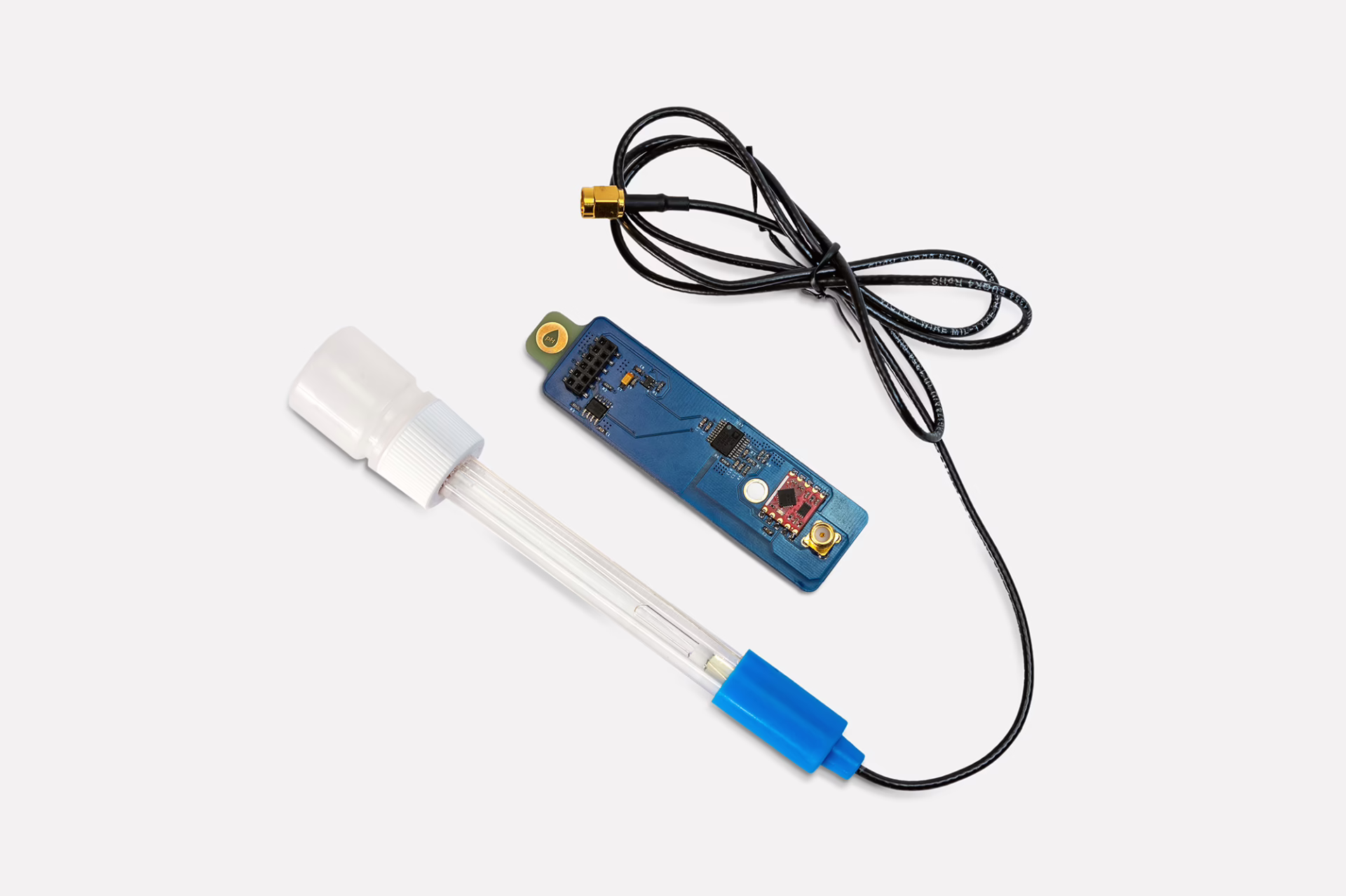
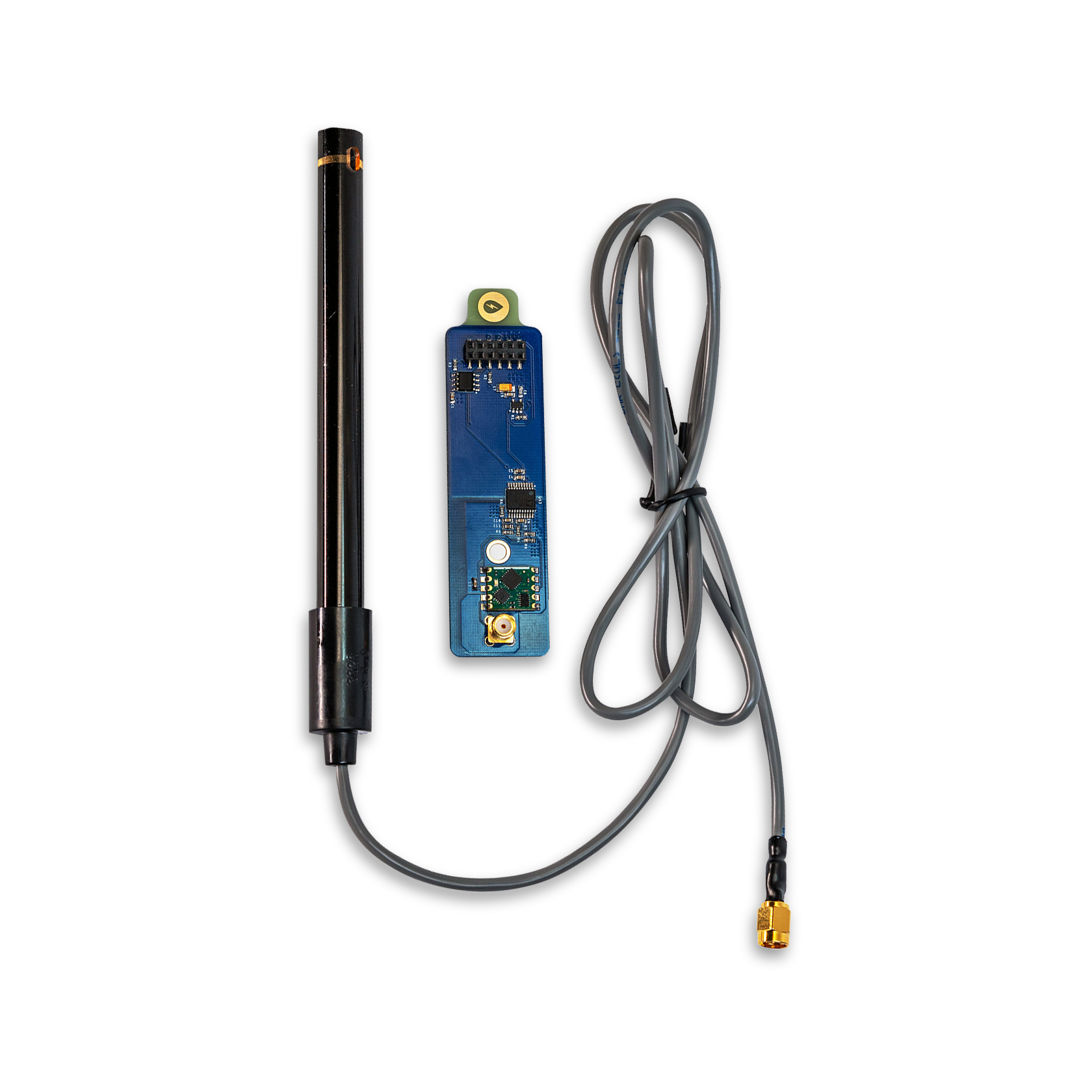
Our pH sensor measures the concentration of hydrogen ions in a given sample of water and uses the pH scale of 0 to 14 to determine the acidity or alkalinity of said water.
| pH | 0.001 to 14.000 (±0.2) pH |
| Probe Diameter | 12 mm |
| Temperature Range | 0-99 °C |
| Cable Length | 2 m |
| Interface | SMA connector on 50 Ω coaxial cable |
| Calibration Period | 6 months |
| Panel Footprint | 1 SMA connector |
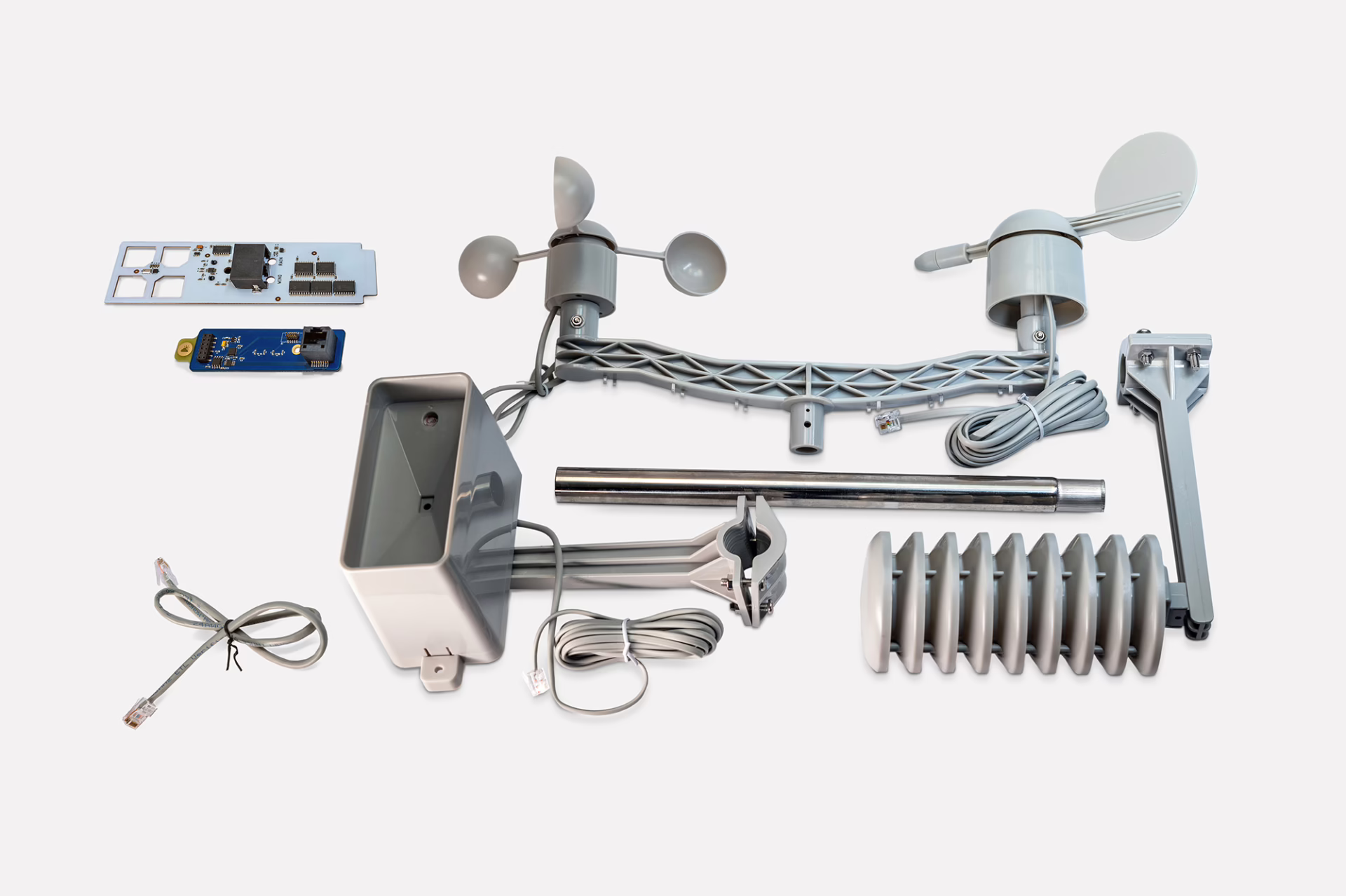
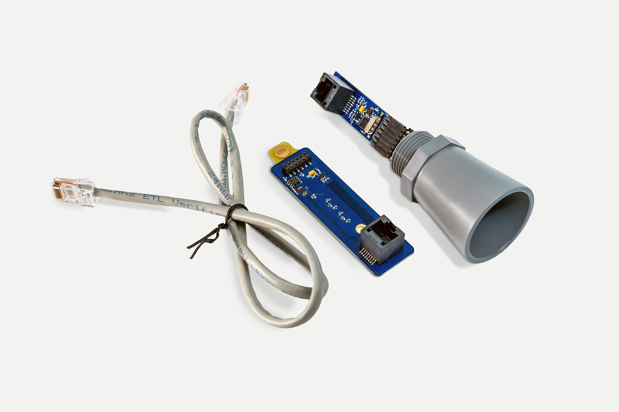
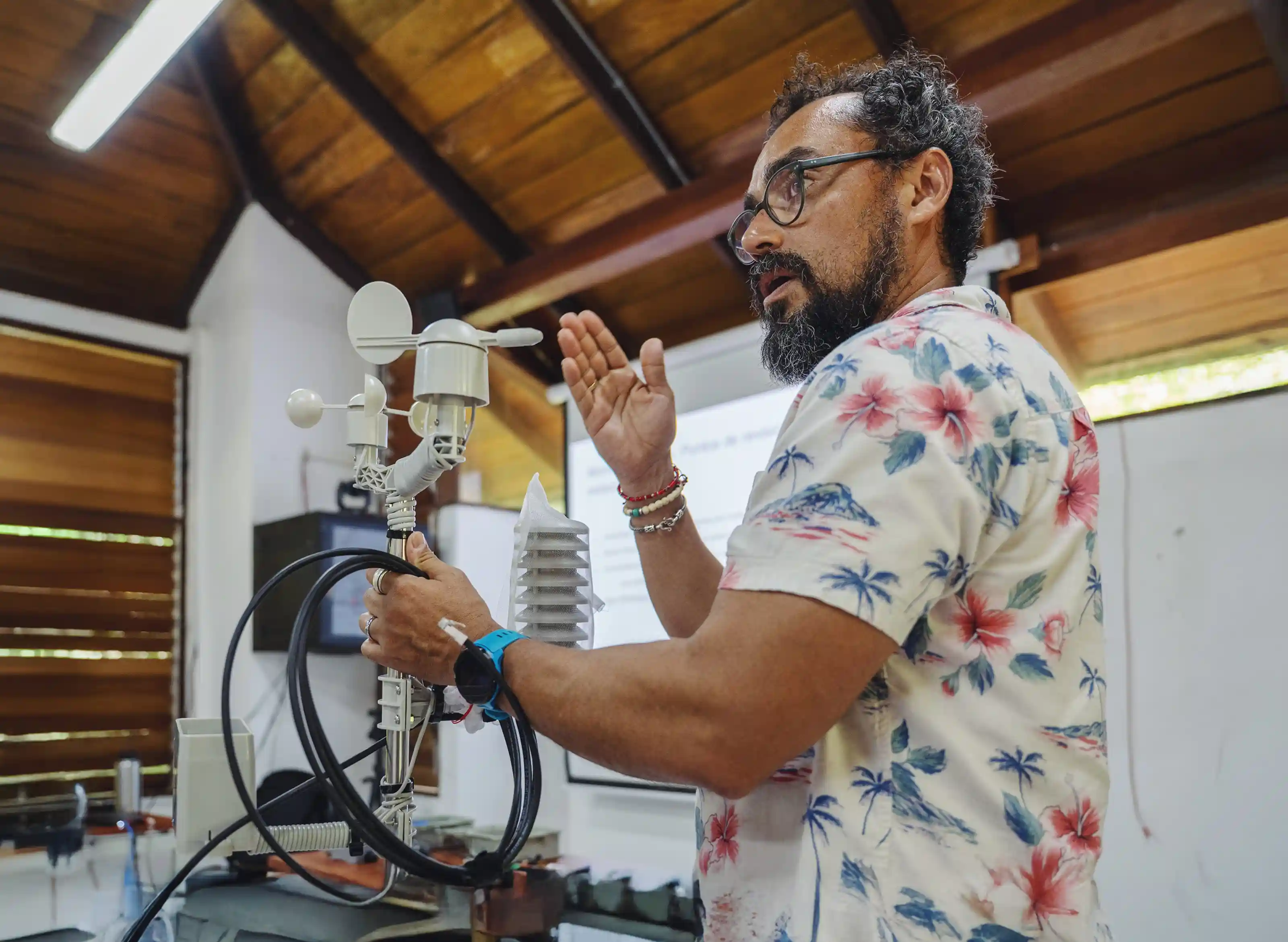
Our weather sensor measures wind speed, wind direction, rainfall, air temperature, humidity, and barometric pressure all with a single module board.
| Temperature | -40.0 to 125.0 (±0.2) ºC |
| Relative Humidity | 0.0 to 100.0 (±2.0) % |
| Barometric Pressure | 50.0 to 110.0 (±0.4) kPa (absolute) |
| Wind Speed | 0 to (±0.33) m/sec |
| Wind Direction | 0–360 (±11.25) º |
| Rain Depth | Continuous sampling in units of 0.2794 mm |
| Interface | RJ45 connector on CAT5 cable or equivalent |
| Calibration Period | 1 year |
| Panel Footprint | 1 PG-19 Cable Gland |
Our distance/level sensor uses an ultrasonic rangefinder to directly measure the distance between the sensor and whatever is below it. This can be placed above a body of water to measure changes in water level or above a location subject to flooding to measure flood depth.
| Distance/Level | 300-5000 mm |
| Temperature Range | -40 to 65 °C |
| Interface | RJ45 connector on CAT5 cable or equivalent |
| Calibration Period | 1 year |
| Panel Footprint | 1 PG-19 Cable Gland |
Deployment Tips
Coming Soon
Design Files and Schematics
Coming Soon
Services
Custom Module Design
We design custom modules for specific sensors or communication technologies to meet your environmental monitoring needs.
FieldKit Integration Support
We can provide the engineering and technical support to create a module board that will interface with your existing sensor, regardless of type.
Deployment Support
We can help develop deployment plans and support fieldwork (including field calibration of sensors) to provide the best possible outcome on your environmental monitoring solution, including the analysis of your data.
Custom FieldKit Implementations
Implement on your own system with a white-labeled instance that incorporates your own data needs, logos, and implementation-specific details.
FieldSchool
We can train your team and local community on environmental monitoring principles, deployment and maintenance of environmental sensors, and data best practices to help build capacity and make your project more successful and impactful.