FieldKit FieldSchool in the Bashakill: A Hands-On Deployment Workshop
For some time now, our team has wanted to try our hands at what we’ve been calling a FieldSchool. Our vision was a workshop helping folks from local community organizations learn the basics of environmental sensing science plus how to build, calibrate, deploy, maintain, and gather data from FieldKit stations for use in their own community initiatives. These FieldSchool content would be customized to be relevant to the attendees present and their goals, the territory in which they would occur, and hands-on and (hopefully) fun.
This past November, we had the opportunity to make the first FieldSchool happen at the Mamakating Environmental Education Center in Wurtsboro, NY. The Bashakill Wetlands is the largest freshwater wetland in southeastern NY, a Wildlife Management Area containing a diverse population of wildlife including over 220 species of birds, 30 species of fish, 200 species of wildflowers, and many amphibian and reptile species. Over the past few years, we have built a relationship with a couple of local organizations who were interested in FieldKit, and when we proposed the idea of doing our first ever FieldSchool experiment there, they were almost as excited as we were.
The inaugural FieldSchool brought together 11 people from seven different organizations across New York for two days. We brought a FieldKit station equipped with sensor modules for temperature, electrical conductivity, and dissolved oxygen, as well as distance (used for measuring water level). We chose this location in part because we have a team member in the area who could help troubleshoot and check on the station.
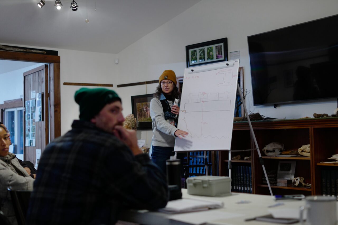
Day one, we covered why environmental sensing matters, hydrology and geospatial basics, and more and visited the site where we planned to do the deployment. Our attendees worked together to build an installation that worked for the site. Day two, the team performed the installation and we took some time to discuss the data itself.
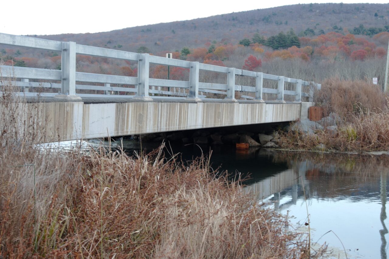
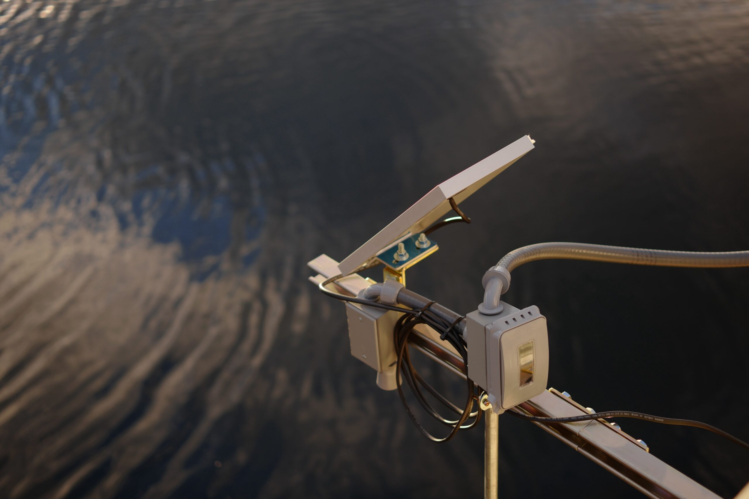
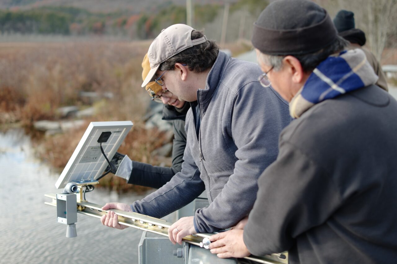
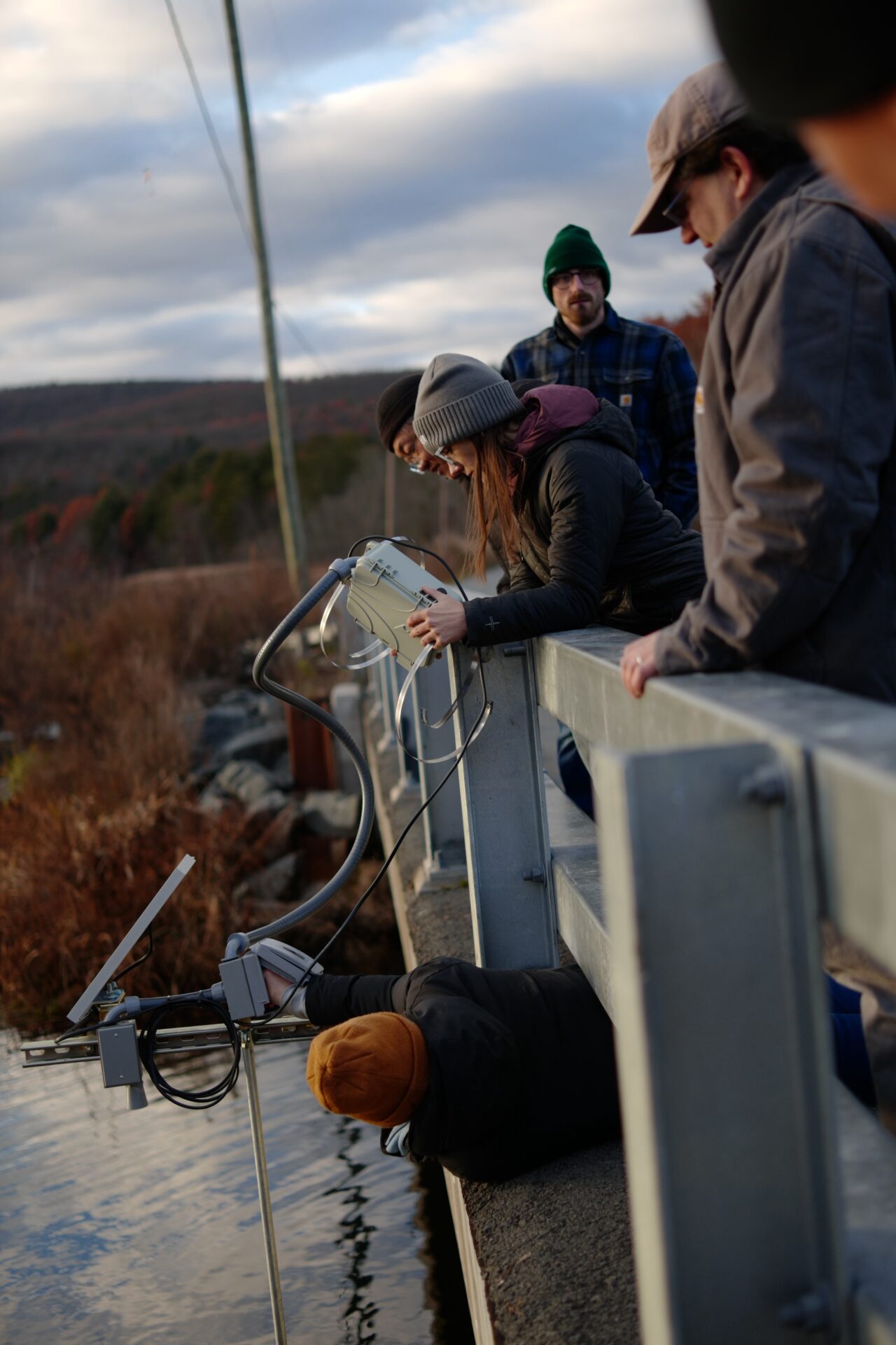
The installation site was a bridge across Haven Road, which we selected because it was readily accessible and served as a good mounting point for the system, allowing us to suspend the water chemistry sensors over the side and get stage height readings with the distance sensor. Additionally, the bridge serves as a pinch point along the Bashakill, creating a mixing effect that means the water column there is more homogeneous. Within the larger watershed, the site is at the local minimum from the upstream side and downstream of most of the major confluences of the creek.
The parameters to be monitored included temperature, which changes the solubility of different chemicals (e.g. oxygen, NaCl, nitrate, phosphate) and dissolved oxygen, which can indicate potential population crashes of species like trout. Changes in both parameters also can affect the metabolism of fish and other animals and the composition of the plant community. Additionally, the station was set up to monitor electrical conductivity, which is proportional to total dissolved solids; most common contaminants—manure, sewage, road salts, debris from construction sites—will boost EC. Finally, we added a distance sensor to measure stage height (i.e. water level), which is useful for understanding flooding, water table depth, and flow rate.
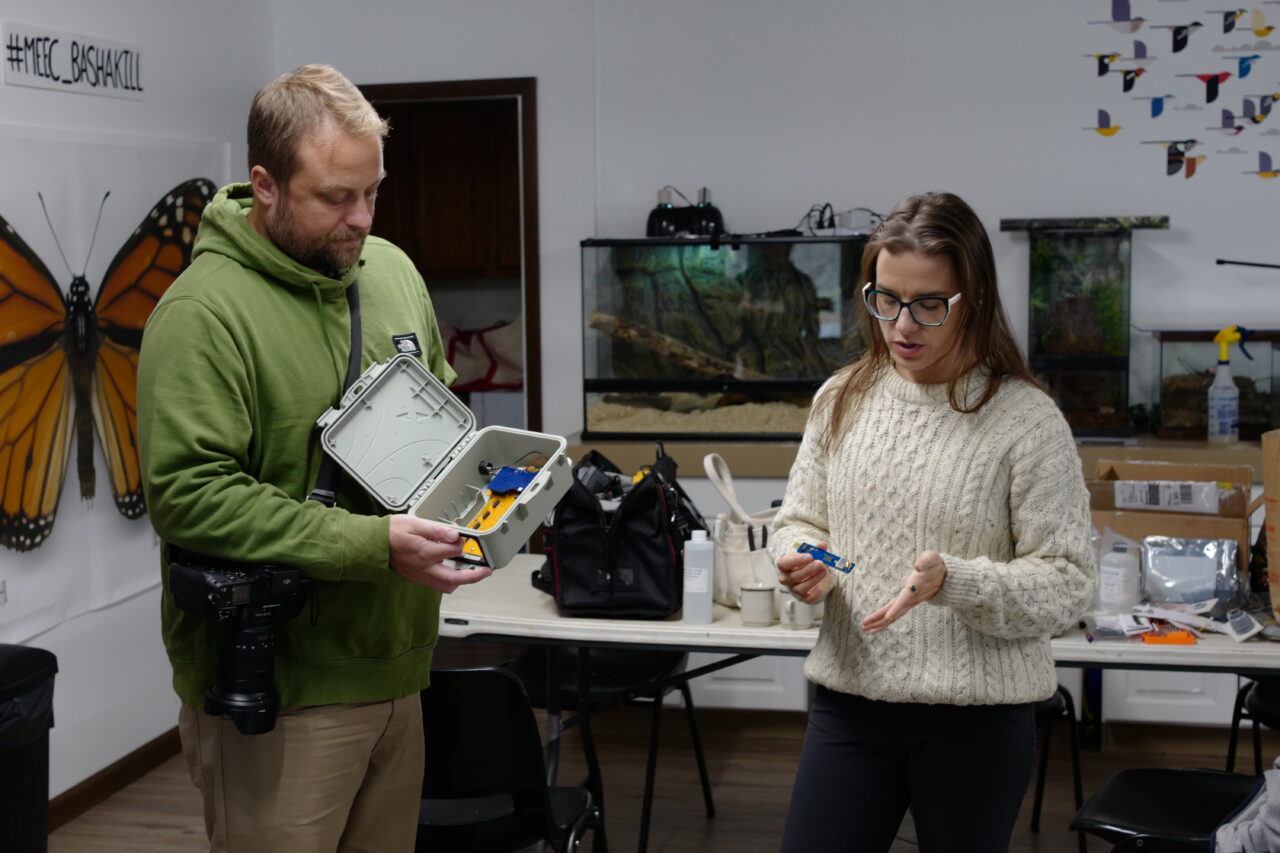
We visited the site ahead of installation to take pictures, measurements, and plan, sketched out the installation plan, and built everything we could at the MEEC center before going into the field (it was VERY cold!). This allowed us to be efficient, while still remaining flexible. Where you locate a station will determine how you do it. However, don’t wait too long to get your installation exactly right—historical data is valuable so get your equipment into the field as soon as you can!
We wrapped up day one ready to get our hands dirty on day two.
We brought lots of potential hardware for the workshop attendees to use to build the installation. The primary mounting material was electrician’s strut, something that we’ve used previously and trust. Strut is durable, weather-resistant, and can be mounted to a permanent structure–in this case, the bridge. We also brought along flexible conduit to protect the cables and an electrician junction box for the distance sensor. The hands-on, practical approach allowed attendees to problem solve together, with guidance from our team.
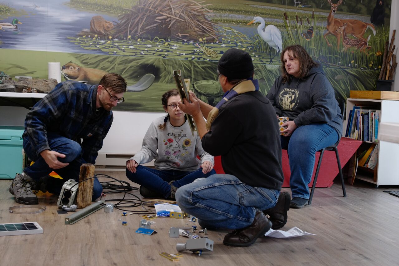
The final installation used two 2’ pieces of 1-5/8” strut, held together by a four-hole plate, four 1/2”-13 bolts, lock washers, flat washers, and nuts. This arm allowed us to project the distance sensor over the water to measure stage height effectively, as seen in the images below. We also were able to use this arm to mount the solar panel to ensure the station remains charged.
A few notes:
Make sure that your deployment is easy to retrieve for inevitable recalibration. Most water chemistry sensors (used by FieldKit and other hardware manufacturers) require calibration in the 3,6, or 12 month span. A difficult to retrieve installation makes this harder.
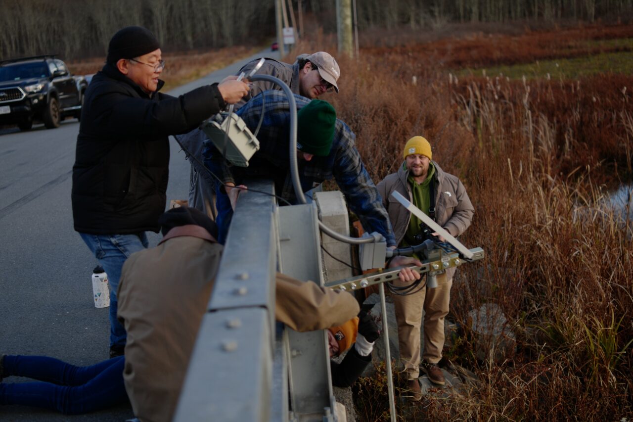
Mount the probes in a way that protects their cables and prevents them from tangling—both amongst themselves and with the ambient environment. In the images shown, you can see the probe management solution our attendees came up with: two 3′ sections of 1/2″ trade diameter galvanized iron pipe joined with a 1/2″ NPT female-female coupler.
Overall, the Bashakill FieldSchool was a great opportunity for people from disparate organizations with different skillsets to come together around mutual interest for mutual flourishing. We are interested in using this model in other areas, working with groups of small, nimble environmental organizations in other areas in the US and around the world.

Thanks again to MEEC for hosting us, and for the attendees from the Basha Kill Area Association, Brooklyn Bridge Park, Catskill Mountainkeeper, the New York State Department of Environmental Conservation, New York Environcom, and the New York State Water Resources Institute. Extra special thanks to John Pratt from Catskill Mountainkeeper for the photography used in this blog post.